
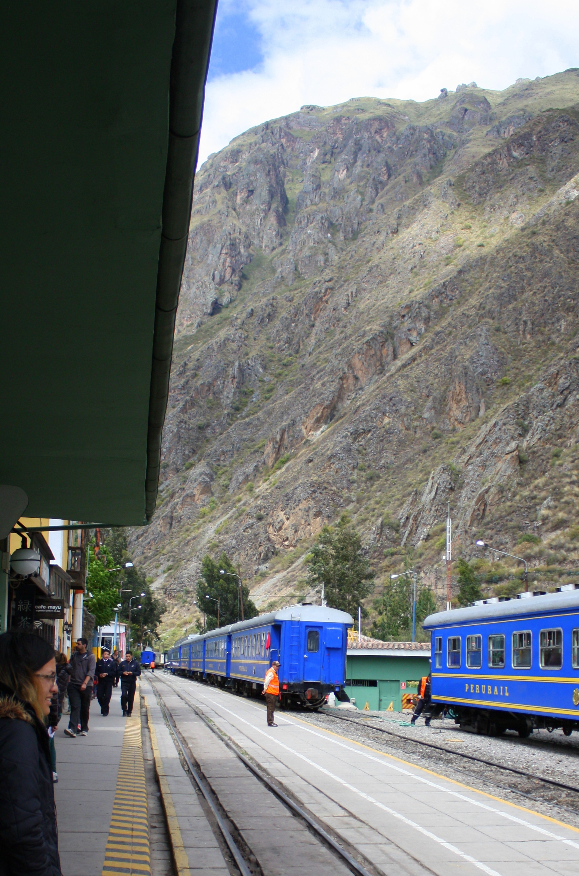
PeruRail station at Ollantaytambo
River, road, and rails often run together through this part of the Valle Sagrada – the Sacred Valley – but the river road turns east into the mountains beyond Ollantaytambo , and anyone not trekking the Inca Trail into Machu Picchu must arrive by train.
The good news is that Peru Rail cars are clean and up to date, the seats are spacious and comfortable, and the ride takes little more than an hour.

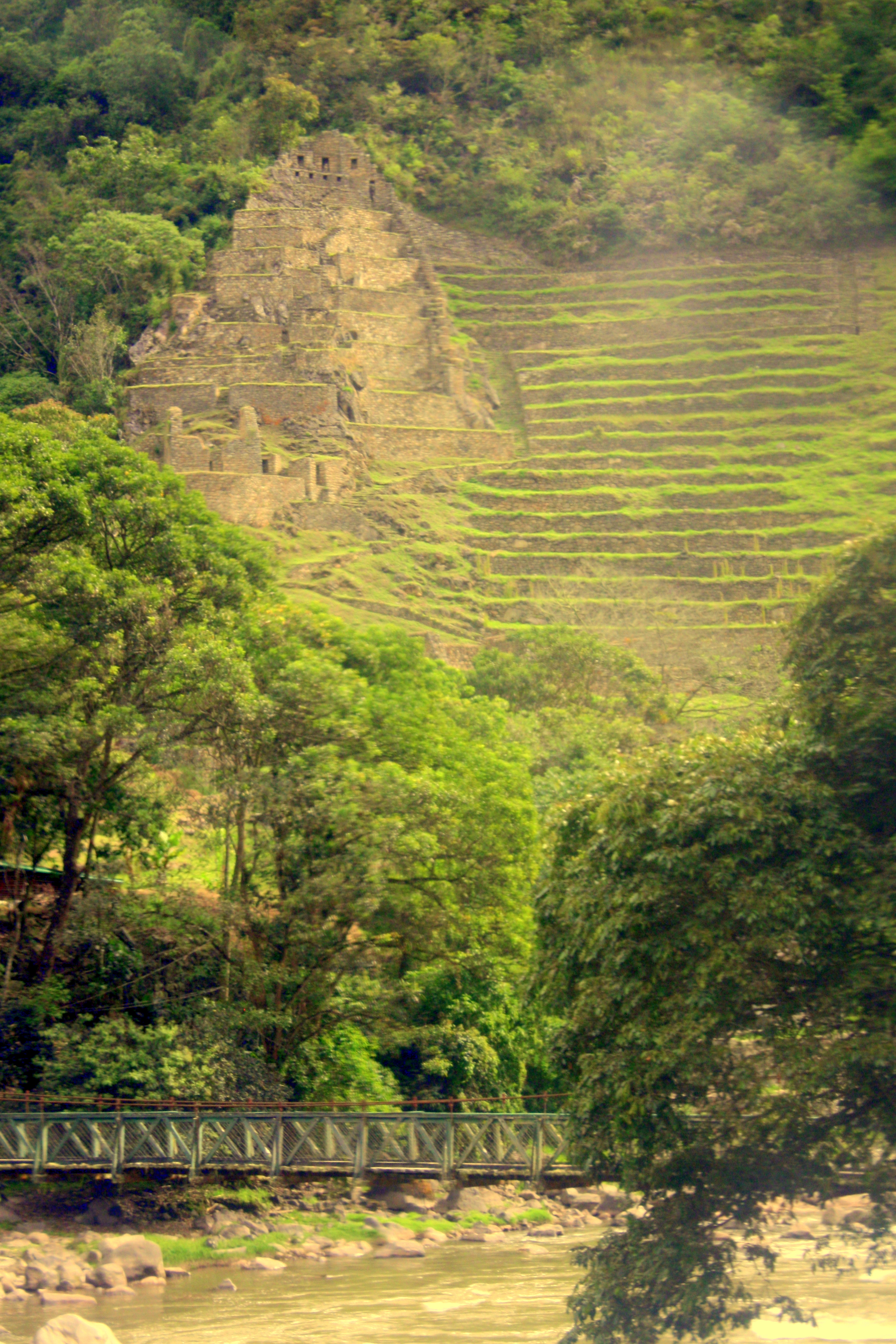
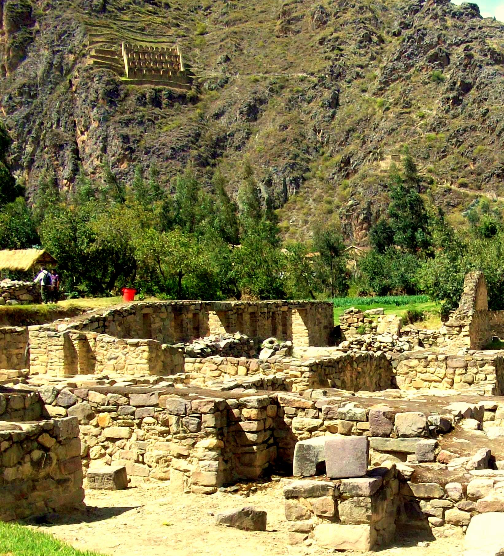
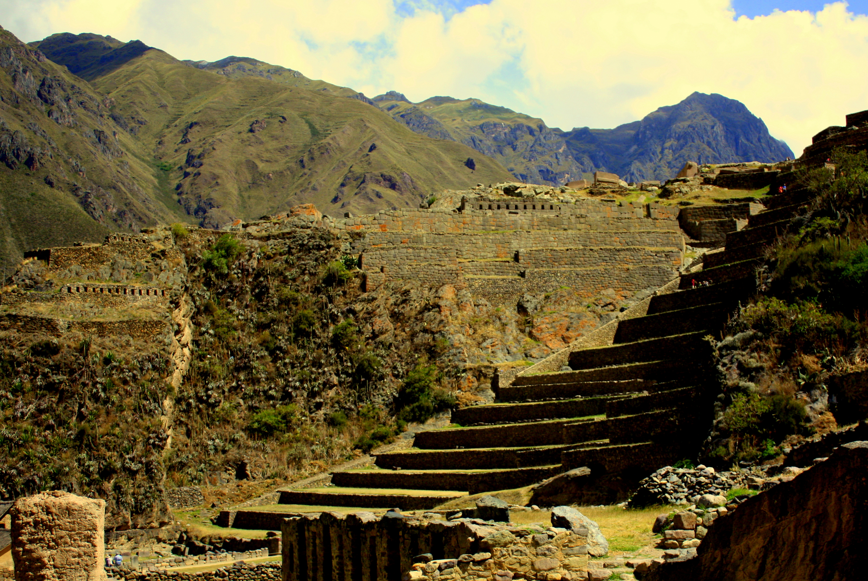
Inca platform on a cliff
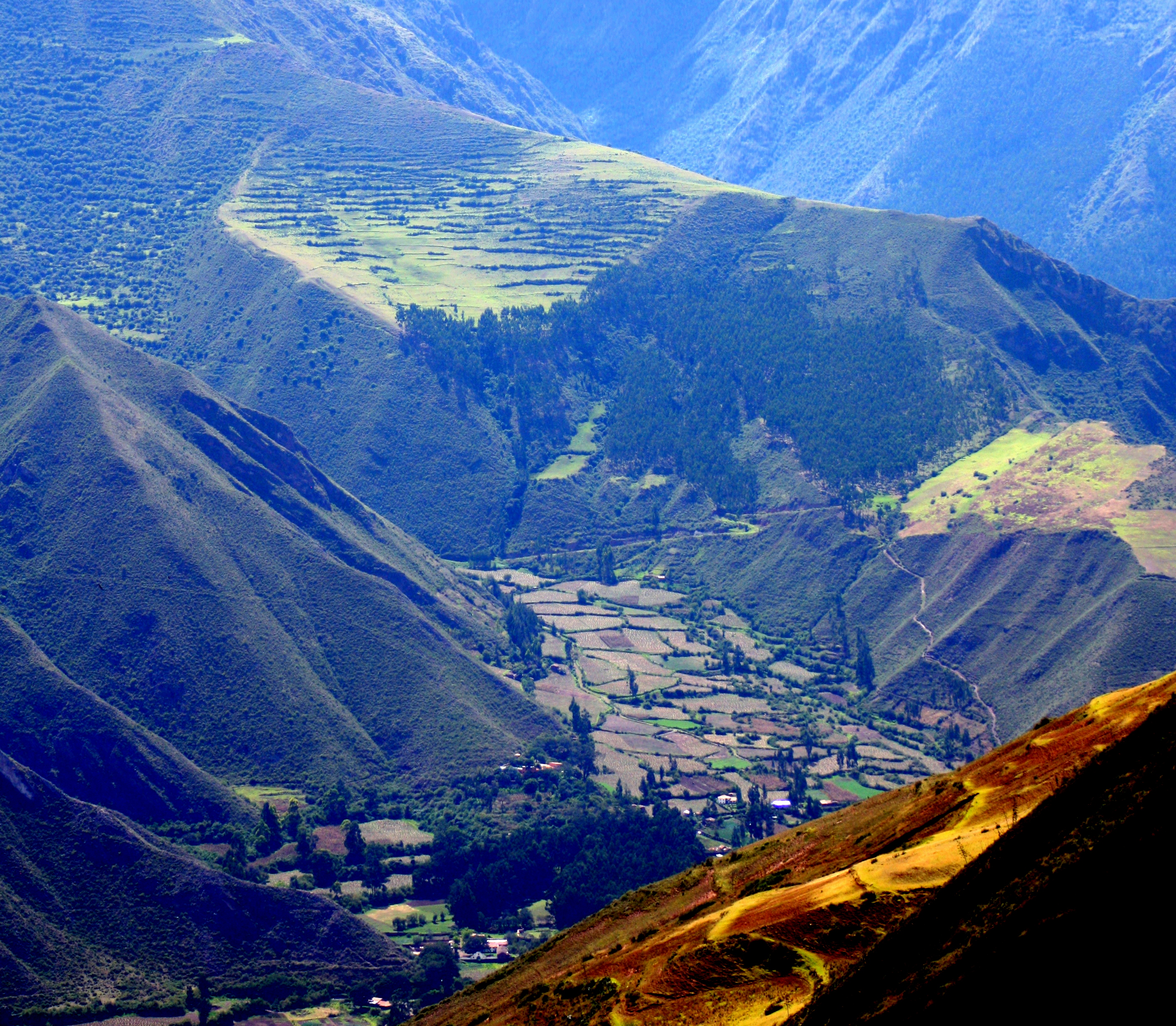
The Urubamba River descends steadily from its headwaters on the far side of Cusco. By the time it reaches Ollantaytambo, it has already dropped by nearly 2,000 feet on its way to the Amazon. It drops by nearly 3,000 feet more as the train follows it to Aguascalientes through twenty miles of changing microclimates.
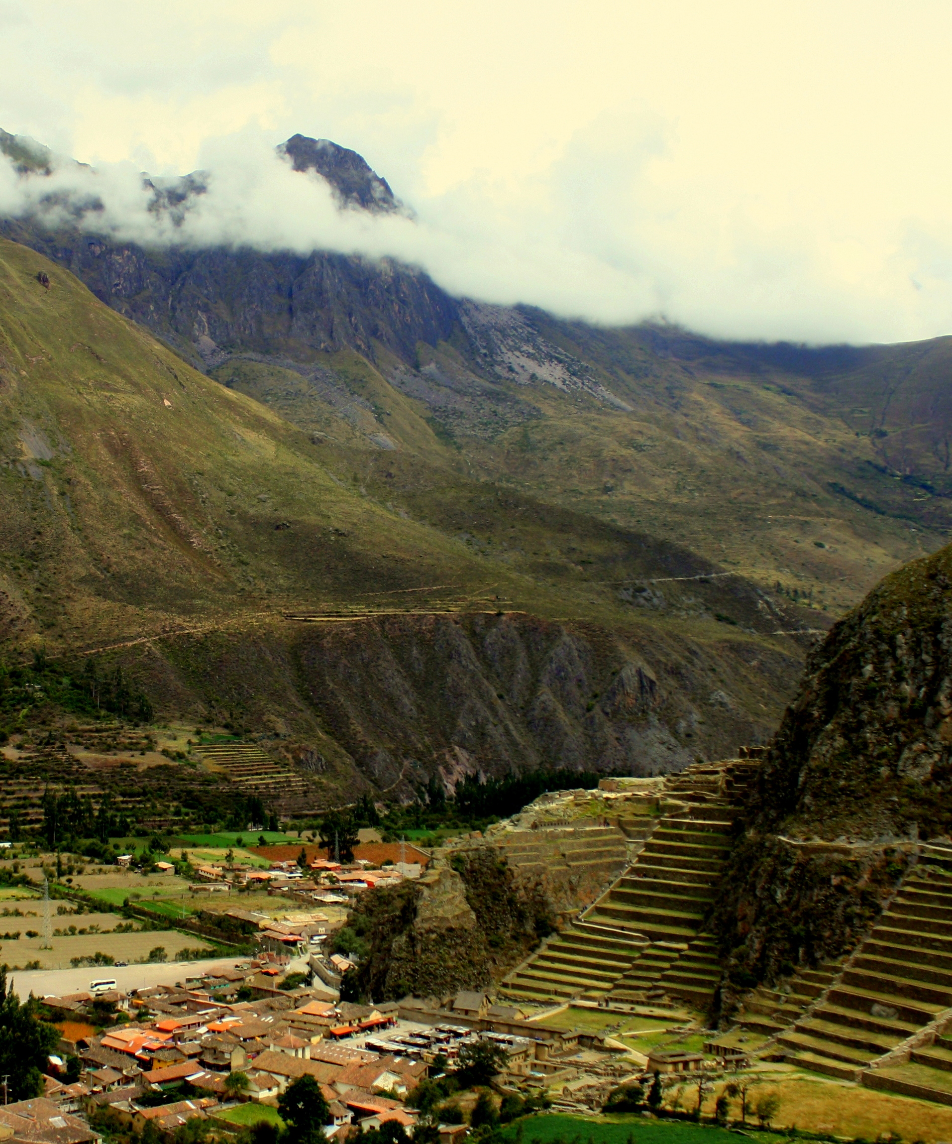
Inca terraces overlooking a footbridge
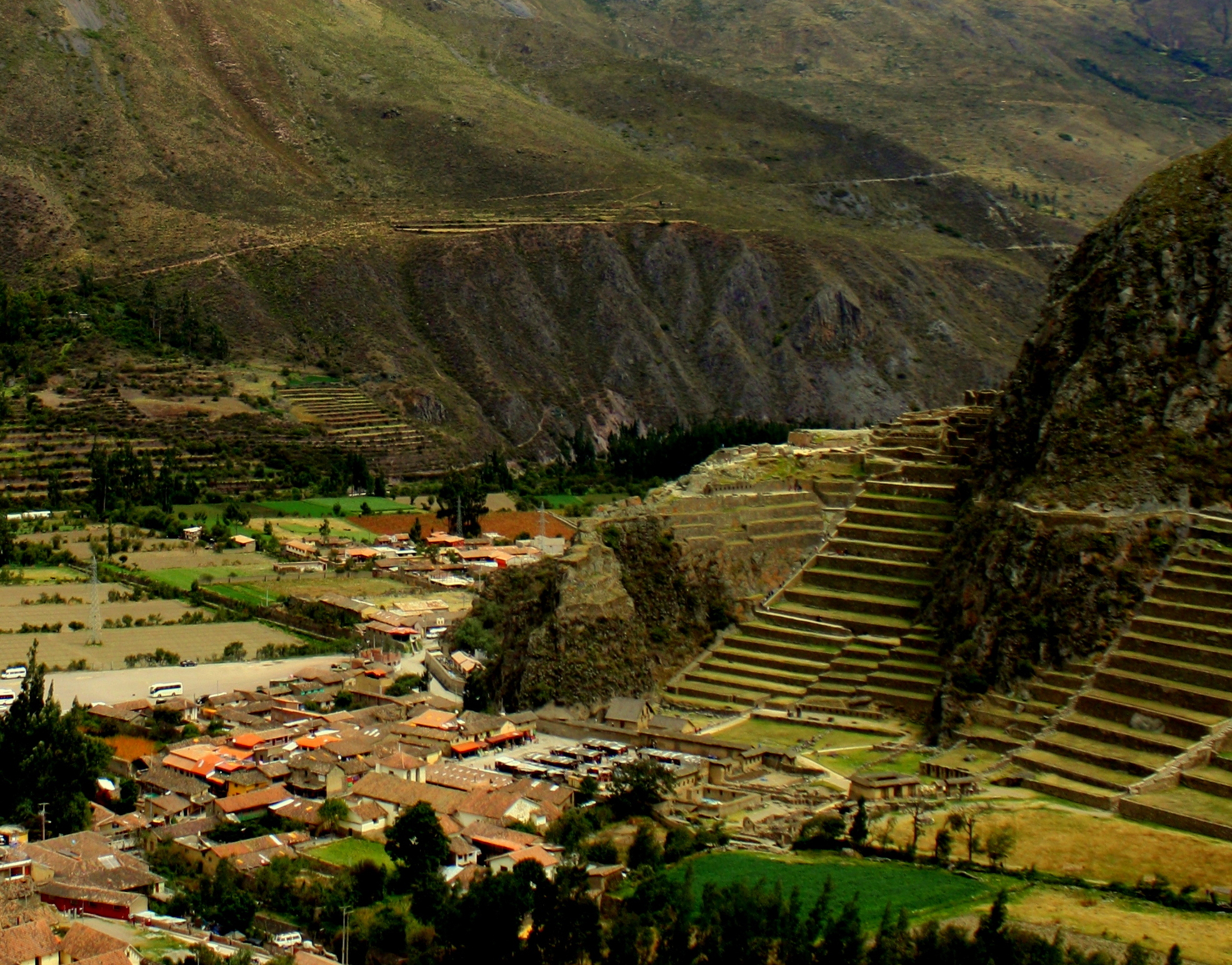
After three days in the Valley, the visitor’s eyes become attuned to flyspecks of Inca terraces and buildings anchored in the vast landscape, or half-hidden by foliage.
They appear with amazing frequency along this route, which drives home the point that there was far acreage under cultivation in Inca times than there is today.
The views are spectacular, and peaks of nearby mountains are sometimes only visible through the train’s vista dome.
From time to time there’s a wait on a siding for a returning train to pass through a one-lane mountain tunnel.

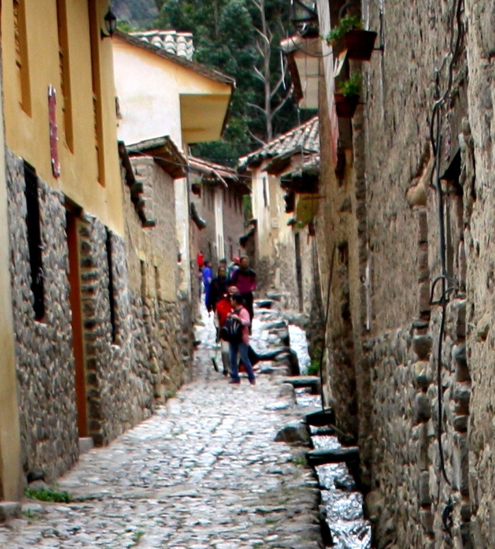
Riverside homes connected only by footbridge
The road has long ago veered away from river and rails, and the scattered hamlets along the river are now connected to the opposite bank only by footbridges.

Boulders worn smooth by rainy season current.
The river grows increasingly turbulent as it plunges ever downward.
The rainy season is still months away and boulders above the low water mark have been worn smooth its raging currents.
Aguascalientes has the look of a Colorado ski village crossed with a Colorado mining town. It’s nestled in a gorge at the foot of Machu Picchu and anyone can walk along every street of its twenty-five square blocks in little more than an hour.
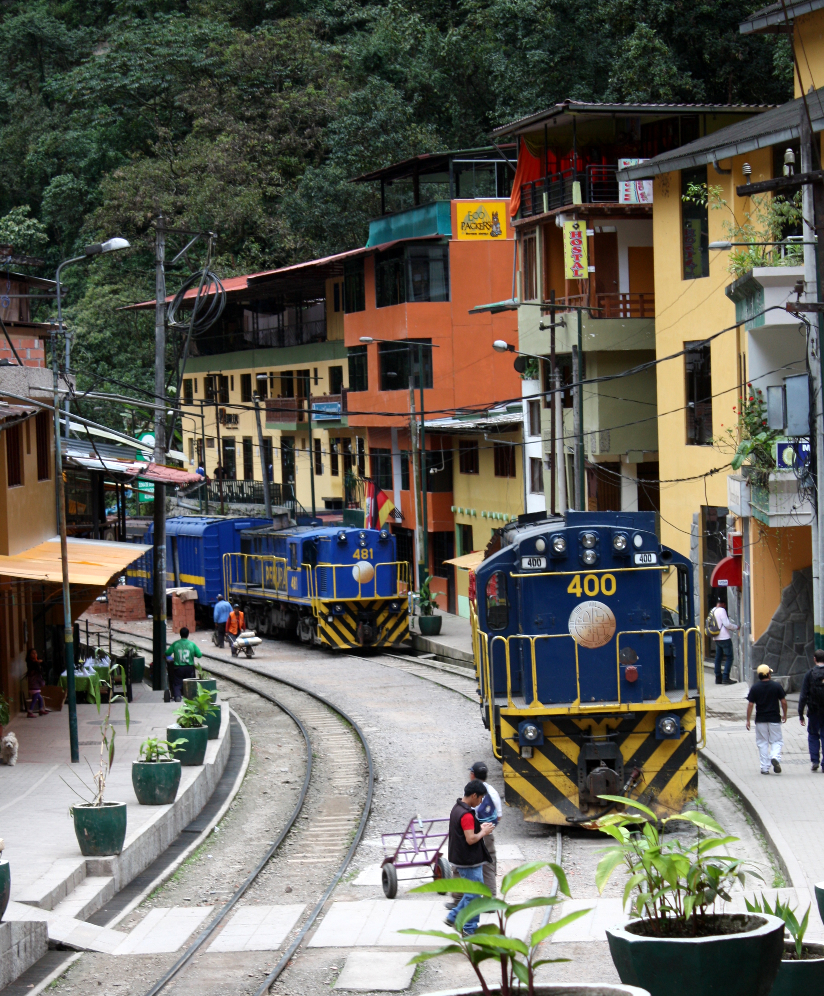
The railroad runs down Aguascaliente’s riverfront street
The riverfront street is split down the middle by the Peru Rail tracks, and although there’s little rail traffic beyond the village, it’s possible to dine at an outdoor table within its reach.

Pedestrian bridges knit the two halves of Aguascalientes together.
The village is divided by a tributary of the Urubamba, and the halves are connected by several bridges from which much of the town is readily visible.

Walking in Aguascalientes almost always involves climbing.
Aguascalientes is a pedestrian delight.
Connected to the rest of the world only by rail, the streets of Aguascalientes are free of any automobiles.

Trash collection without the garbage truck.
Construction materials, restaurant deliveries, and even trash collection rely on porters and hand trucks.
There is no lack of good restaurants here, but there are far more pizzerias, wi-fi coffee houses, and Peruvian restaurants with menus barely distinguishable from each other.

The “Inca Cross”
A walk through the village turns up dozens of images of the Chacana, popularly known as the “Inca cross”.
It’s a square superimposed upon a cross with arms marking the four compass points. It symbolizes the Incas’ view of a three-level world:
Hana Pacha, the upper world in which the gods reside.
Kay Pacha, the world of living people.
Urin Pacha, the underworld inhabited by spirits of the dead.
Aguascalientes takes its name from the therapeutic hot spring at its upper end which can be a welcome stop for anyone who’s overdone a day of hiking.
There are also massage therapists on almost every street corner, and in combination bath and massage makes for a great wind-down after a day on the mountain

A dark-skinned Christ wears an Inca robe.
A peek into a church on the main plaza turns up the recurrent image of a crucified Christ robed in an Inca tunic.
Unlike most of the Christ images in Peruvian churches, this one is dark-skinned.
Young women in traditional garb are gathered in anticipation of the Mother’s Day celebration which is just beginning to crank up.

Girls in traditional garb in advance of the Mother’s Day celebration.
Tonight’s a night to turn in early, though, because the plan for tomorrow is to beat the crowds and catch the sunrise over Machu Picchu. Come along.
Some tips:
- Only a limited number of Machu Picchu tickets are issued for each day, which will require you to also have round trip reservations for the train and bus shuttle tickets to and from the site.
- You may encounter baggage restrictions if boarding the train at Ollantaytambo, so consider taking with you only enough baggage for a couple of days and leaving excess baggage at the station checkroom.
- You’ll also want to have room reservations in Aguascalientes for at least the night before or after your Machu Picchu visit… or maybe both.
While some Machu Picchu aficionados spend every minute of a full day on the site, even a casual tourist accompanied by a knowledgeable guide should plan on spending no less that 2-3 hours there.
The crowds are at their lightest at opening, and on Sundays.
- I used the services of GoToPeru for all of my in-country travel, for reservations and ticketing to cultural sites. Their guides are excellent and I highly recommend their service.


